University of Adelaide research has for the first time statistically proven that the earliest standing stone monuments of Britain, the great circles, were constructed specifically in line with the movements of the Sun and Moon, 5000 years ago.

Callanish_aerial_picture_1687x1265

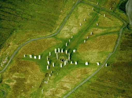
The Callanish Stones were erected in the late Neolithic era. They are an arrangement of standing stones placed in a cruciform pattern with a central stone circle 13 metres (43 feet) in diameter, situated near the village of Callanish on the west coast of Lewis in the Outer Hebrides, Scotland. Image credit: Gail Higginbottom & Roger Clay / RCAHMS.

The research, published in the Journal of Archaeological Science: Reports, details the use of innovative 2-D and 3-D technology to construct quantitative tests of the patterns of alignment of the standing stones.

.

“Nobody before this has ever statistically determined that a single stone circle was constructed with astronomical phenomena in mind — it was all supposition,” says project leader and University of Adelaide Visiting Research Fellow Dr. Gail Higginbottom, who is also a Visiting Research Fellow at the Australian National University.

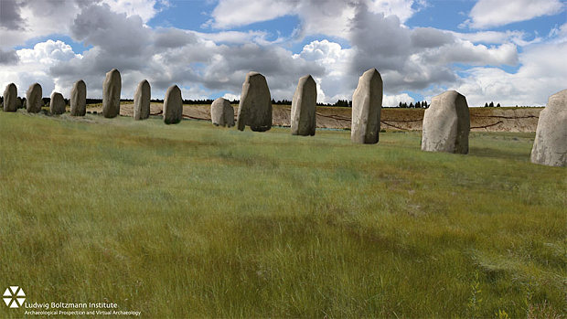
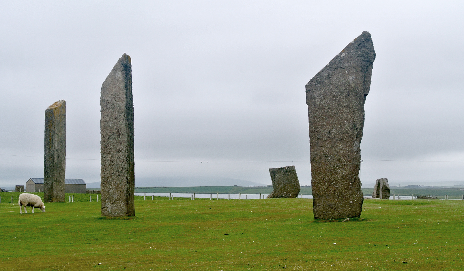
Examining the oldest great stone circles built in Scotland (Callanish, on the Isle of Lewis, and Stenness, Isle of Orkney — both predating Stonehenge’s standing stones by about 500 years), the researchers found a great concentration of alignments towards the Sun and Moon at different times of their cycles. And 2000 years later in Scotland, much simpler monuments were still being built that had at least one of the same astronomical alignments found at the great circles.

The stones, however, are not just connected with the Sun and the Moon. The researchers discovered a complex relationship between the alignment of the stones, the surrounding landscape and horizon, and the movements of the Sun and the Moon across that landscape.

“This research is finally proof that the ancient Britons connected the Earth to the sky with their earliest standing stones, and that this practice continued in the same way for 2000 years,” says Dr. Higginbottom.

The circle of the Stones of Stenness is 32.2 x 30.6 metres (106 x 100 feet). Its earthen henge is 45 metres (148 feet) in diameter, over 7 metres (23 feet) wide and over 2 metres (6.5 feet) deep and the circumference is 141.37 metres (464 feet). Image credit: Wikimedia Commons.
The Standing Stones of Stenness is another Neolithic monument — possibly the oldest henge site in the British Isles — located five miles northeast of Stromness on the mainland of Orkney, Scotland. The stone circle measures 32.2 x 30.6 metres (106 x 100 feet), surrounded by an earthen henge 45 metres (148 feet) in diameter. Image credit: Wikimedia Commons.

Examining sites in detail, it was found that about half the sites were surrounded by one landscape pattern and the other half by the complete reverse.

“These chosen surroundings would have influenced the way the Sun and Moon were seen, particularly in the timing of their rising and setting at special times, like when the Moon appears at its most northerly position on the horizon, which only happens every 18.6 years,” Dr Higginbottom says.

“For example, at 50 percent of the sites, the northern horizon is relatively higher and closer than the southern and the summer solstice Sun rises out of the highest peak in the north. At the other 50 percent of sites, the southern horizon is higher and closer than the northern, with the winter solstice Sun rising out of these highest horizons.

“These people chose to erect these great stones very precisely within the landscape and in relation to the astronomy they knew. They invested a tremendous amount of effort and work to do so. It tells us about their strong connection with their environment, and how important it must have been to them, for their culture and for their culture’s survival.”

Article SourceAstronomy Now

Join one of our guided tours of Stonehenge or Avebury and hear all the new theories.
The Stonehenge Experts
http://www.StonehengeTours.com


A line of huge megaliths that once acted as a site for rituals carried out during the building of Stonehenge has been discovered. Here is how to visit the site

Why go

Archaeologists have discovered the remains of a massive stone monument buried under the bank of a stone-age enclosure known as Durrington Walls, just two miles from Stonehenge.

A new line of stones has been found under Durrington Walls super-henge

A new line of stones has been found under Durrington Walls super-henge

Using powerful ground-penetrating radar, investigators from Birmingham and Bradford universities, alongside an international team of experts, have uncovered a 330m-long line of more than 50 massive stones, buried under part of the bank of Britain’s largest pre-historic henge.

Professor Vincent Gaffney, an archaeologist on the project, said that the discovery has significant implications for our understanding of Stonehenge and its landscape setting.

“Not only does this new evidence demonstrate a completely unexpected phase of monumental architecture at one of the greatest ceremonial sites in prehistoric Europe, the new stone row could well be contemporary with the famous Stonehenge sarsen circle or even earlier,” he said.

What is it

Gaffney said that the stones are thought to have been erected more than 4,500 years ago to form a dramatic ritual arena. The monuments were grand, built to give the impression of authority to the living and the dead.

However, as the megaliths are buried underground, visitors to the area will not be able to see them for themselves.

Yet you can still get a great sense of their majesty if you use a bit of imagination, and Durrington Walls, the village where Stonehenge’s builders lived, is itself an interesting site.

The henge at Durrington Walls has long mystified archaeologists because one side is straight while the rest of it is curved. It surrounds several smaller enclosures and timber circles, and is connected to a newly excavated later Neolithic settlement. Thousands of people travelled great distances to gather here and feast on roast pork and apples in midwinter. The area outside the ditch and bank was once a settlement, possibly housing hundreds of homes, making Durrington Walls the biggest village in north-west Europe at the time.

Durrington
The earliest phase of Durrington Walls with its line of megaliths

How to see the site on a guided walk

The National Trust is hosting a Discover Durrington Walls event on October 10. On this 3-mile walk, you’ll explore the secrets of Durrington Walls – once home to the builders of Stonehenge – and discover 6,000 years of hidden history with National Trust’s landscape guides.

To book: Call the estate office on 01980 664780 or email stonehenge@nationaltrust.org.uk

How to see the site on an independent walk

Download a National Trust map for one of the following routes and explore for yourself.

1. Ramble around on a Durrington Walls and Landscape walk and explore the connection between two of the most important henge enclosures in the country in a less-known part of the Stonehenge World Heritage Site. To view the route: nationaltrust.org.uk/wra-1356324449264/view-page/item463554/

2. Go on a Durrington Walls to Stonehenge walk and discover the landscape in its full glory from the Bronze Age barrow First World War military railway track, as well as its diverse wildlife and plants. To view the route: nationaltrust.org.uk/stonehenge-landscape/things-to-see-and-do/view-page/item937063/

Join a guided tour from London or Salisbury

Stonehenge Guided Tours operate daily tours of Stonehenge and many of their small group tours explore the greater landscape including Woodhenge and Durrington Walls.  Exclusive private guided tours can be arranged for individuals, families and small groups with local experts.  They also specialise in Stonehenge special access tours.  To view their tours: http://www.StonehengeTours.com

Local facilities

– Picnic area (not NT) and information panel at Woodhenge car park

– WCs

– Outdoor café

– Picnic area (not NT) at Stonehenge car park, 0.75 miles from this walking route.

How to get there

Bike: National Cycle Network route 45 runs south-east of the property. See sustrans.org.uk

Bus: Wilts & Dorset 5 or 6, between Salisbury, Pewsey, Marlborough and Swindon. Service 16 from Amesbury, request stop at Woodhenge

Rail: Salisbury station, 9 miles from Woodhenge car park

Road: Woodhenge car park is 1¾ miles north of Amesbury, follow signs from A345

This article was written by Trisha Andres (Telegraph Mail)

Stonehenge Guided Tours
The Stonehenge Experts
Touring Stonehenge since 1995