When commercial traveller, photographic inventor, and amateur antiquarian Alfred Watkins wrote up his lecture expounding his theory about ancient routemarkers in Early British Trackways (1922), delivered to the Woolhope Club of Hereford only five months previously, he started a movement, some would say a craze, which shows no signs of diminishing even in the cold light of the 21st century.

From his business peregrinations up and down the Welsh Marches Watkins deduced that prehistoric travellers must have created a system of routes and landmarks to aid navigation, and upon realising this he felt he ‘held in [his] hand the key plan of a long-lost fact’. When he glimpsed in an epiphanic flash ‘the original sighting pegs used by the earliest track makers in marking out their travel ways’, it seemed as though a secret map of Britain had been revealed to him. Such a claim met with ‘violent opposition’, but he fine-tuned his controversial theorem in The Old Straight Track: its mounds, beacons, moats, sites and mark stones, his influential monograph published in 1925. Watkins drew upon archaeological, topographical, and etymological evidence, tested by exhaustive field research. He postulated that alignments had developed over a long period of time – beginning in the Palaeolithic – and that navigational aids were placed along them, starting with simple piles of stones (walkers’ cairns, such as can be found on many summits and popular walking routes across Britain), which were sometimes developed into megalithic monuments, churches, towers, follies, and so forth, through the ages, the initial purpose fading in the mists of time: ‘The straight track became an organised possession of the community for all to use, but mystery and reverence for a superior knowledge grew round its making and its mark-points’. Critically, Watkins did not perceive these ‘leys’, as he called them (from the Anglo-Saxon word for a clearing, and linked to ‘sight’) as in any way supernatural. He emphasised the practical application: ‘Utility was the primary object’. Only later, Watkins suggested, did such sites become co-opted for religious purposes, such as the predominance of churches dedicated to the Michael on hill-tops – the archangel who is commonly depicted as slaying the dragon with his spear, or ‘fixing the point’, focalising the serpent energy of the land in geomantic terms.
Yet Watkins’ revolutionary idea was tantalising enough to inspire generations of ‘ley-hunters’, and it is hard not to be caught up in his vision when he, in a rare moment of lyricism, waxes about his grand vision: ‘imagine a fairy chain stretched from mountain peak to mountain peak, as far as the eye could reach, and paid out until it touched the “high places” of the earth at a number of ridges, banks, and knowls.’ Watkins envisioned ponds and streams being deliberately enhanced to reflect beacon fires lit upon the high places. Anyone who has stood upon Glastonbury Tor on a sunny day would have witnessed this phenomenon, as the sunlight reflects off the dykes that thread the Somerset Levels, creating chains of light across the land.
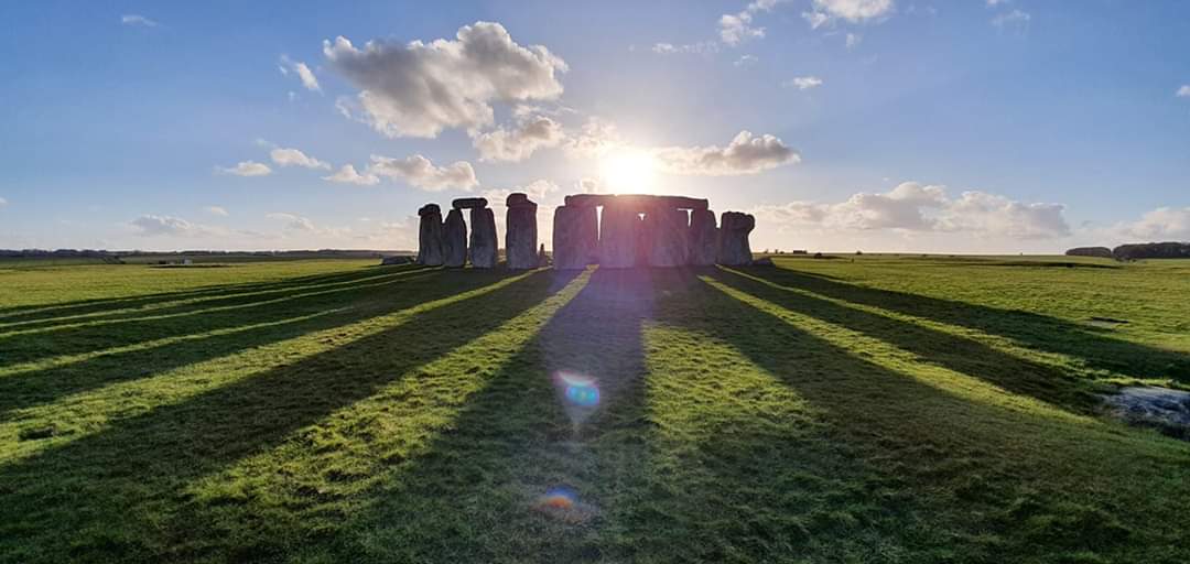
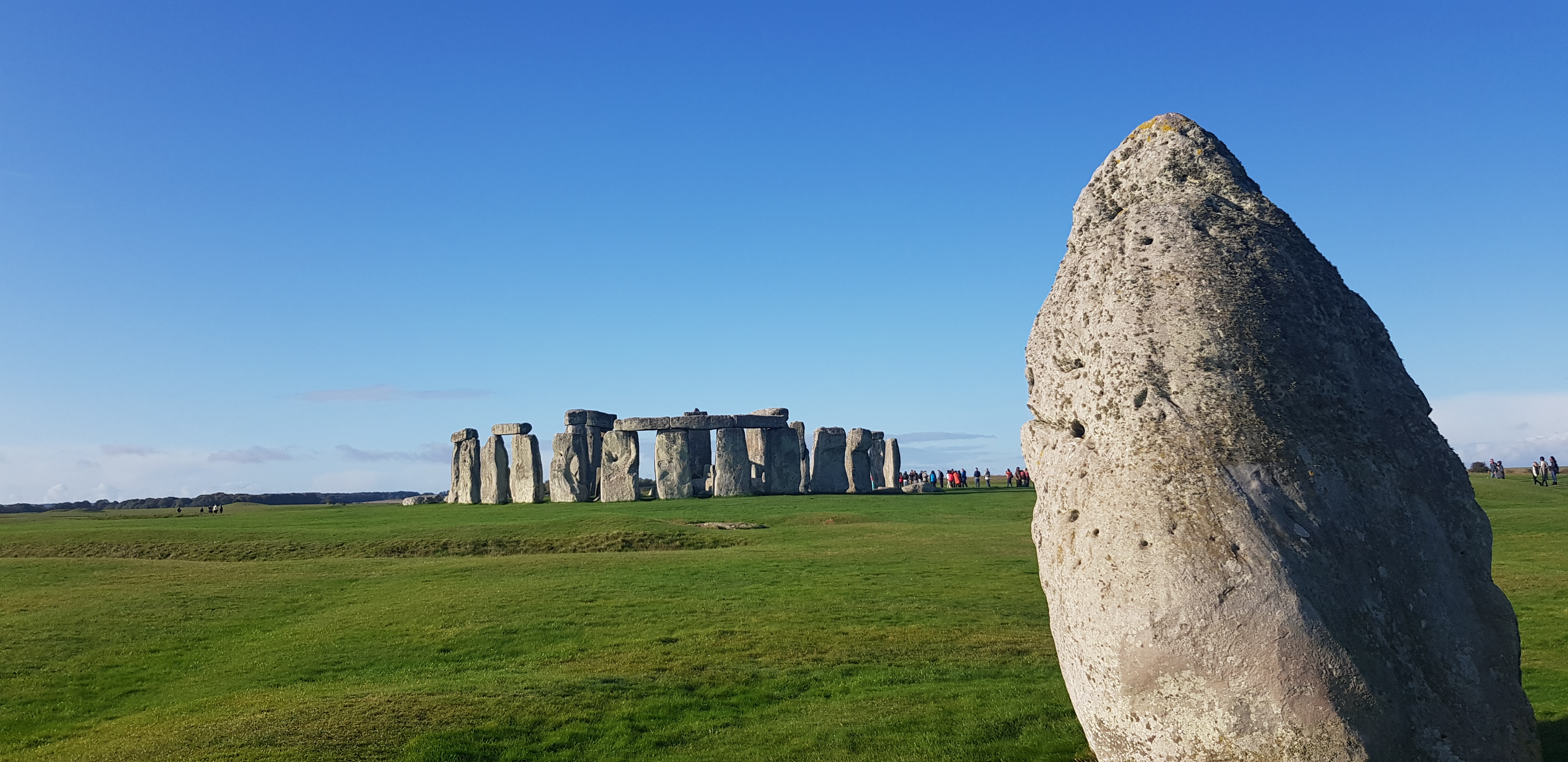
And Watkins’ vision was to act like a beacon fire to many who followed. His work was taken up in the late Sixties by antiquarian and occult author John Michel, in The View Over Atlantis (1969), who took Watkins’ ideas, and run with them – reconceptualising his ‘leys’ as ‘leylines’, a matrix of energy stretching across not only Britain, but the world, and connecting ancient sites such as the Pyramids of Giza, Uluru (Ayers Rock), Machu Piccu in Peru, and Stonehenge. These energy lines were seen as the meridians of the planet, to use the analogy from Chinese acupuncture, with sacred sites acting as ‘needles of stone’ (an idea crystallised by Tom Graves in his 1978 book). Leylines had gone viral, a meme that the Counter Culture adopted as their own. Some have tried to adopt a scientific approach to their study, most notably Paul Deveraux, who has undertaken extensive field research at sacred sites, (the Dragon Project of the late Seventies), yet the leyline theory is largely discredited by archaeologists. It is argued that you could draw a random line on a map and the probability is that it will intersect ‘sacred’ or historic sites; also, that the sites offered as evidence of a ley vary so widely over time and usage that no single, coherent purpose can be applied to them. And yet humans, the pattern-making creature, love to see patterns. We are biologically hard-wired to respond to simulacra – from our mother’s face, to human forms in nature. We seek meaning in what is otherwise a random, meaningless universe. It is no wonder we fashion lines of narrative, or song, to guide us – internally and externally – across life’s journey. It is something we have been doing for at least fifty thousand years, as the complex system of the Aboriginal dreamtime, with its songlines, attests. It seems unlikely that such an intuitive (and useful) way of mapping only developed in a single place on Earth. Enigmatic monuments like the Nazca lines in Peru, and the cursus in England, suggest otherwise. Deveraux suggests these could be ‘spirit roads’, and are a macrocosmic version of the countless ‘corpse paths’ found in many cultures. Certainly, there is more to such routes than the prosaically utilitarian. Some historic routes, such Roman roads, droveways, saltways, the ‘herepaths’ (or military track) of Alfred the Great, General Wade’s roads across Scotland, and so forth, clearly did have a primarily practical purpose – and although sometimes these overlap with other, older routes or usages, there are too many obscurer routes, ‘hidden paths that run towards the moon, or to the sun’ (as Tolkien put it), to be simply ignored. And the fact is (perplexing as it may be to an empirical, rationalist paradigm) that many of them can be dowsed. They are discernible, and anyone with a pendant, rod, or sensitive persuasion, can detect them. Many converge at Stonehenge – the Spaghetti Junction of leylines (or Mother Node, if you prefer) – and cross the land and beyond, as Hamish Miller and Paul Broadhurst have pointed out. Something is there, and what that signifies – Palaeolithic navigational aids, geomagnetic earth energies, the meridians of Mother Earth, ghost paths, extraterrestrial guidance beacons – who can rightly say? Perhaps the true nature of such alignments depends on the awareness and paradigm of the one seeking them – we find the road we wish to walk; the evidence to support the theory we wish to believe. It seems ley/lines are to be experienced, more than understood – and they add a little bit of mystery to a world suffering from a dearth of the imagination. They provide a counter-narrative, of other ways of experiencing reality, one that opens up, rather than shuts down possibility. It turns the prose of the everyday into a poem, even a song. They offer another way of being in the landscape. Choosing to follow these invisible paths is an act of faith – like The Fool in the tarot, the seeker steps off the precipice of reason and hopes their vision will sustain them. It certainly sustained Watkins. So, it feels right and fitting to give the man who started it all the last word: ‘Such alignments are either facts beyond the possibility of accidental coincidence or they are not’.
SOURCE: The Stonehenge News Blog
If this has whetted your appetite and you want to go explore the mysteries of Stonehenge further then have a look at our exclusive Stonehenge special access tours or even organise a specialist ‘New Age Experience’ Tour and try your skills at dowsing
Stonehenge Guided Tours
WINNER: Best Stonehenge Tour Specialists 2020 / 2021
WINNER: Best ‘Historical Tour’ Operator 2020 / 2021
Operating Stonehenge Tours Since 1990
www.StonehengeTours.com